
Climate of Kenya

Kenya is bisected by the Equator, yet knows three kinds of very different climate: hot and humid along the coast (map 1), temperate in the West and Southwest where mountains and plateaus (map 2), torrid and dry in the North and East (map 3).
In General in the country the hottest time in Kenya is February to March, while the cooler is July-August, although seasonal variations in temperature are contained.
Temperature and rainfall vary according to the prevailing winds, which determine two seasons: from December to mid-March winds prevail warm and dry from Arabia (Kaskazi, a wind that blows from the north-east to south-west for about 4 months), while from April to mid-September prevail the most fresh and moist winds blowing from the south-east from the Indian Ocean (Kuzi or Kusi, a wind blowing mainly from the south for about 6 months). The short period of transition from mid to late March is the result of the change between Kaskazi and Kuzi. The transitional period from mid-September to mid-November, said Matalai, is determined by the change of wind from Kuzi to Kaskazi – a period of rain and little wind.

At the beginning of the two periods, and in correspondence with the two passages of the Sun at zenith, will determine the two rainy periods: the “long rainy season” (big rain) from March to May, and the less intense “short rains season” (small rain) from October to December, while in the Western Highlands it rains a lot between June and September. Rainfall is most abundant along the coast and in the Southwest (zones 1 and 2), swing by the typically 800 to 2,000 mm per year, while in arid area (3) drops below 500 mm.
Rainfall occurs mainly in the form of reverse or afternoon or evening time. They are however quite uneven; on the one hand with global warming are declining rainfall in certain areas, on the other hand, during the years of the Niño increases the probability that there are abundant rains.

On the coast it’s very hot from November to March, with the maximum around 31/32 degrees (but with 36/37 tips) and high humidity. As pleasant as the June-August period, when it comes down to around 28 degrees. In January and February it rains a little, while in March and December you can some backhand especially in the southern part of the coast (see Mombasa). The long rainy season here has moved forward with the rest of Kenya and goes from April to June, with May as the rainiest month. The best months are August and September: the less hot, sunny and well not abundant rainfall, in the form of brief showers that leave space in the Sun soon. The short rains season is felt just in the northern part of the coast (see Lamu), a little more to Malindi and Mombasa, with some upside down in October and November, generally not intense. It must be said, however, that depends: sometimes it can rain a lot between October and December, and especially in November. On average, however the coast 1,000/1,100 mm fall per year.
In short, the climate mostly on the coast:
July / August – The weather is changeable with alternating rain and sun, wind and calm. Races of windsurfing and sailing, great waves for surfing a good month to visit the parks.
September – The wind is calm and the season fishing and diving begins, the sea becomes calmer and thus end up surfing. Begins the migration of animals in Kenya to the Serengeti.
October – The sea temperature becomes warmer. This is the period in which takes place on Malindi Fishing Festival, a competition that attracts fans of fishing, world-class deep sea.
November – A few, sporadic rains earlier this month and later, with the fall of Kuzi (the monsoon blowing from the southeast), the sea becomes still and clear, perfect for all sports.
December / January – With the Kaskasi, the northeast monsoon, the sea gets a little rougher but is still good for all water sports. The temperature begins to become warmer. Great period of “high society” on the coast.
February / March – The weather is very hot and dry, the nonexistent wind, the slower pace of life ideal for tanning and sunbathing.
April – The fishing season ends while diving continue until the arrival of the southeast monsoon.
May / June – With the monsoon Kuzi the rain comes, the waves are higher and perfect for those who love surfing. Deep sea fishing and other water sports are no longer recommended.

On the plateau the climate is generally temperate. The temperature and rainfall vary depending on altitude and exposure, however typically the relief promotes the formation of storm clouds, so the more you more salt increases the risk of rain, and even in dry seasons can erupt any time. At higher altitudes, above 3,000 metres the night temperature can drop below freezing, and occasionally this can happen above 2,500 metres.
The Nairobi capital is near the Equator, to 1,600 metres altitude. The altitude makes the climate temperate and pleasant, but with cool nights, so that maximum temperatures oscillate around 21/22 degrees cooler months (June, July and August) at 25/26 of the warmer months (January, February and March), while the lowest descend around 10/11 degrees from June to September and 12/14 from January to April. In July and August, the sky is often overcast though rain; and it’s cool at night can make even cold, in fact, sometimes you can get off around 5 degrees. During the two rainy seasons, March-May and November-December, rains often, though even here the rains come in the form of reverse, leaving space in the Sun. The sunniest months are January and February, although there is some downside in this period.
The faunal reserve of Masai Mara, which adjoins the Serengeti in Tanzania, is located at a latitude averaged around 1,500 metres. Here they fall more than 100 millimeters per month from March to May and from October to December, and the rainiest month is April with 200 mm. There is however a completely dry season, although July is less rainy month with about 60 mm.

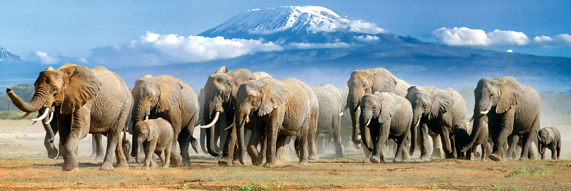
The parks of the South-Eastern area of the country are generally more and more arid than the heart of the plateau. Amboseli National Park lies in the South, to 1,100 meters, and a short distance from the border with Tanzania beyond which lies the Kilimanjaro, hanging giant on the horizon. There a arid savanna, in which elephants roam freely in addition to many other animal species such as lions, cheetahs, Impalas, hyenas, giraffes, zebras, and where you can meet the Masai villages.
Similar situation in huge Tsavo National Park, which is located further East, and is divided into two: Tsavo East and Tsavo West. The altitude varies from 500 to 1,000 meters in West Park, and from 200 to 800 in the East. Higher the Chyulu Hills National Park, ranging from 900 to 2,100 metres above 1,800 meters: there is a cloud forest, but also a range of volcanic peaks and lava tunnels which make the lunar landscape.
In the highlands Northwest of Nairobi, above 2,000 metres, the rainfall pattern is a little different than the rest of the country: even in July and August, which are generally little rainy months in the rest of Kenya, rains are plentiful, both ranging from 100 to 200 mm per month. It is mostly afternoon or evening showers. In this area (see Eldoret, Nakuru, or the parks as Kakamega, Nandi South, Mount Elgon, Mau Forest) you exceed 100 millimeters a month from April to September, while the relatively dry season goes from October to March.
Lake Nakuru, where you can admire the pink flamingos, is 1,750 metres.
The highest peak of the country is Mount Kenya, 5,199 meters high, which has different climatic zones depending on the altitude and slopes (the South-Eastern part is wetter): cloud forest above 2,000 metres, bamboo around 2,500 metres in the North that is more arid, over 3,000 Heath, high altitude desert above 4,000. Over 4,700 meters are some glaciers, the largest of which is the Lewis glacier, unfortunately in retreat because of global warming.
West of Mount Kenya, the Aberdare Mountains almost 4,000 meters. Very high even on Mount Elgon, 4,321 metres high, whose top is located in Uganda.
Belongs to Kenya a portion of Lake Victoria, located at 1,100 meters.
The North is the most dry and hot area of Kenya, in particular the areas that lie at lower altitudes. Lake Turkana (or Rudolph) is located 365 metres; Here the landscape is semi-desert in the South and desert in the North, where the annual precipitation fall under 100 mm per year. In this area the heat is scorching all year: in Lodwar is the daily average around 30 degrees all year, except in July and August when it drops to 28/29 degrees. The rains are sporadic and irregular, however it is more likely that there is some upside down in two rainy periods of Kenya, from March to May and October to November.
Even the Northeast bordering Ethiopia and Somalia is torrid and dry, and even here the poor and irregular rains fall in two periods March-May and October-November. In this hot area, July and August are the months that you leave prefer because they are less hot. To learn about the living conditions of people living in these areas, I invite you to read the blog “The thirst of Kenya“.

To make beach life, on the best months are August and September, because they are less warm and sunny enough and are a little rainy. Wishing you can also choose January and February, which is the driest of the year, but are more warm and sultry. On the other hand are those in which the sea is calm and clear for diving. The sea is warm enough to make the bathrooms throughout the year: the temperature varies from 24 August to 28 degrees in March and April.
To visit the Northern arid areas, July and August are the months less hot, but really there is not much difference compared to the rest of the year: the heat is intense, however.
For a safari in the National Parks and in the Highlands, you can choose from two periods: from June to September, and January-February. In the first period there is a greater risk of afternoon and evening showers at high altitudes, in the second that the heat will be heard at lower altitudes. Agrees however to dress in layers because in the early hours of the day and the highest odds can make cool all year round.
Recall that the equatorial sun is very strong and is even stronger when you share rooms: the two months when the sun is stronger because it enters the zenith are March and September.
Last days 12 hours year-round, so the sun rises around six in the morning and sets at around 6 pm, and is used by locals as a clock.
The least period is March-May in the Interior, and April-June on the coast, which is typically the wettest and what presents the greatest risk of flooding, particularly in April in inland areas and May on the coast.

Climatic data historians Malindi
Height: 22 meters
Latitude: 03 14S
Longitude: 040 06E
The average temperature of the year in Malindi is 80.0 ° F (26.7 ° C).
The hottest month on average is March with an average temperature of 83.0 ° F (28.3 ° C).
The coldest month on average is July, with an average temperature of 77.0 ° F (25 ° C).
The maximum temperature recorded in Malindi is 104.0 ° F (40 ° C), which was recorded in January.
The lowest temperature recorded in Malindi is 55.0 ° F (12.8 ° C), which was recorded in August.
The average amount of rainfall during the year in Malindi is 22.8 “(579.1 mm).
The month with the most rainfall on average is April with 5.0 “(127 mm) of rain.
The month with less precipitation average is June with an average of 0.4 “(10.2 mm).
In terms of precipitation, there are on average 99 days of rainfall a year, with more rainfall in the month of May (17 days) and less rainfall in September (2 days).

Weatherbase
The time throughout Kenya
Choosing the location you will learn about:
the current weather conditions
the weather forecast
monthly weather averages for:
-temperature
-precipitation
-humidity
-wind
-sky conditions
-solar radiation
 WINDFINDER
Wind, waves and weather for surfers and sailors.
Nairobi – Mombasa – Malindi – Watamu – Che Shale – Lamu Island
 SURF forecast
Surf Forecast and Surf Reports Worldwide
Malindi Bay Surf Forecast and Surf Reports
Watamu Bay Surf Forecast and Surf Reports
Mombasa Channel Surf Forecast and Surf Reports
 Earth Wind Map Indian Ocean
Malindi: -3°13′ S, 40°07′ E
Nairobi: -1°16′ S, 36°49′ E
Lamu: -2°16′ S, 40°54′ E
Kisumu: -0°06′ S, 34°45′ E

METEOSAT
Indian Ocean

Fishing Weather
Tide table and solunar charts for Kenya
Fishing Weather – To learn about the forecast for high and low tides and other useful data, as the lunar phase, tidal coefficient, time of sunrise and sunset of the sun and moon, hours of maximum fish activity, weather conditions on the coast Indian Ocean.
